Client:
Auckland City Council
Auckland City Council link opens in a new tab
Project Owner:
Auckland City Council
Auckland City Council link opens in a new tab
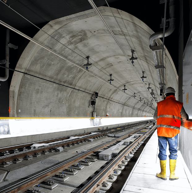
Atlas InSAR monitoring pinpointing thousands of landslip risk zones across 1,250km² after Auckland’s record floods and Cyclone Gabrielle.
Auckland City Council
During the evening of 27 January 2023, the Auckland region was subject to a huge deluge of rain in only a few hours. The rain continued over the weekend, where half of Auckland’s typical average annual rainfall fell across Auckland during this time. This caused widespread flooding leading to a State of Emergency declared and homes in the worst affected areas to be evacuated. This was intensified further by Cyclone Gabrielle the following weekend. These two extreme weather events resulted in destruction in the form of flooding and land slips.
The Problem
Those two severe weather events, have generate hundreds of visible land slips with more or less critical consequences. But what about the areas that have moved but are not – yet – visible and represents a threat in the future? Having previously worked with Sixense to monitor ground deformation and soil expansivity across the region using Sixense’s Atlas-InSAR monitoring system, the Auckland council engaged Sixense to assess the areas over the wider Auckland that are showing vertical and horizontal movements after the heavy rain and cyclone.
What We’ve Delivered
Sixense delivered Atlas-InSAR ground deformation monitoring and reporting services to the Auckland Council. This included advanced data analytics of land slips using the adoption of algorithms, artificial intelligence (AI), and machine learning to identify thousands of areas affected by the extreme weather events. The InSar study covered an area of 1,250 km2 using the Sentinel constellation. Sixense’s Atlas InSAR processing chain produced 3 million time-series data points that were analysed to locate vertical and horizontal movement related to the weather events. ATLAS InSAR data demonstrated exceptional effectiveness in detecting and monitoring ground deformation across the Auckland region and identifying key areas affected by these extreme weather events on a scale
Images of the project
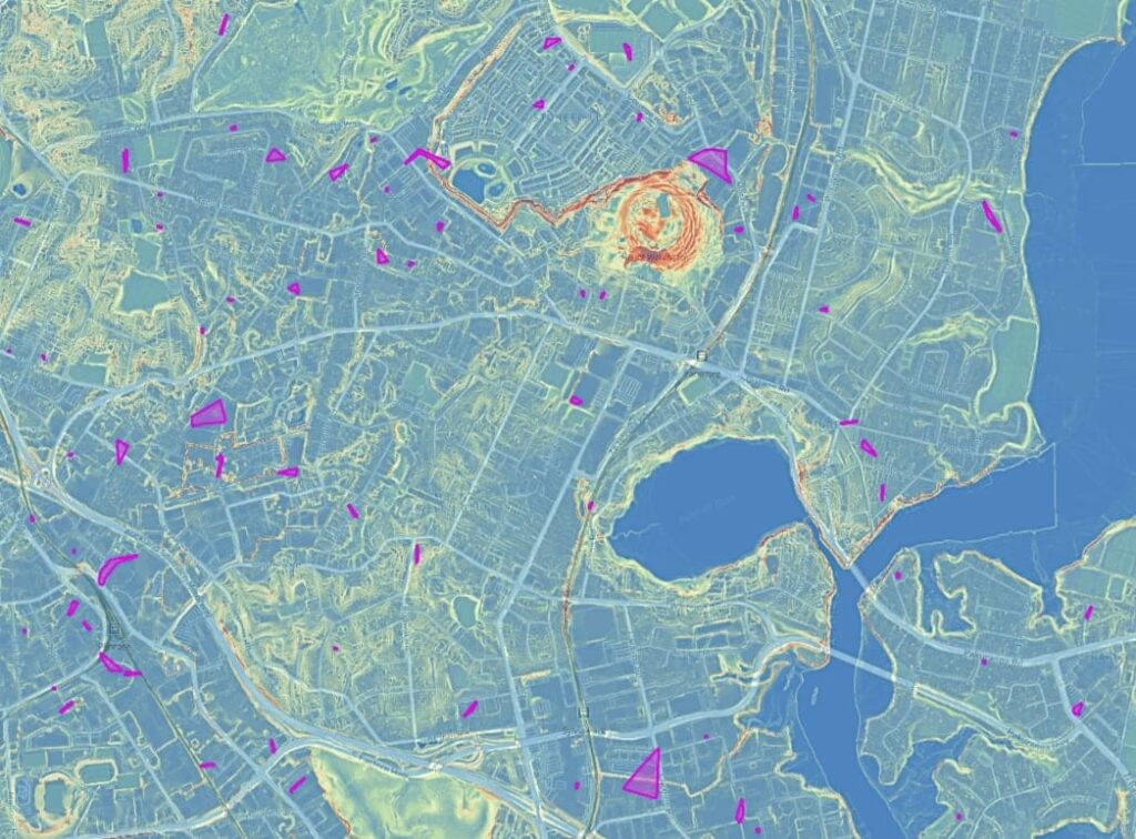

InSAR measurement points
Area of analysis
Zones impacted
Satellite orbits