Client:
The Suburban Rail Loop Authority
The Suburban Rail Loop Authority link opens in a new tab
Project Owner:
Victoria State Government
Victoria State Government link opens in a new tab
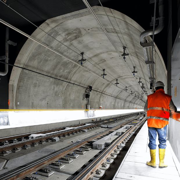
High-resolution InSAR baseline monitoring with artificial corner reflectors, detecting long-term ground movement trends ahead of Melbourne’s 90 km Suburban Rail Loop.
The Suburban Rail Loop Project
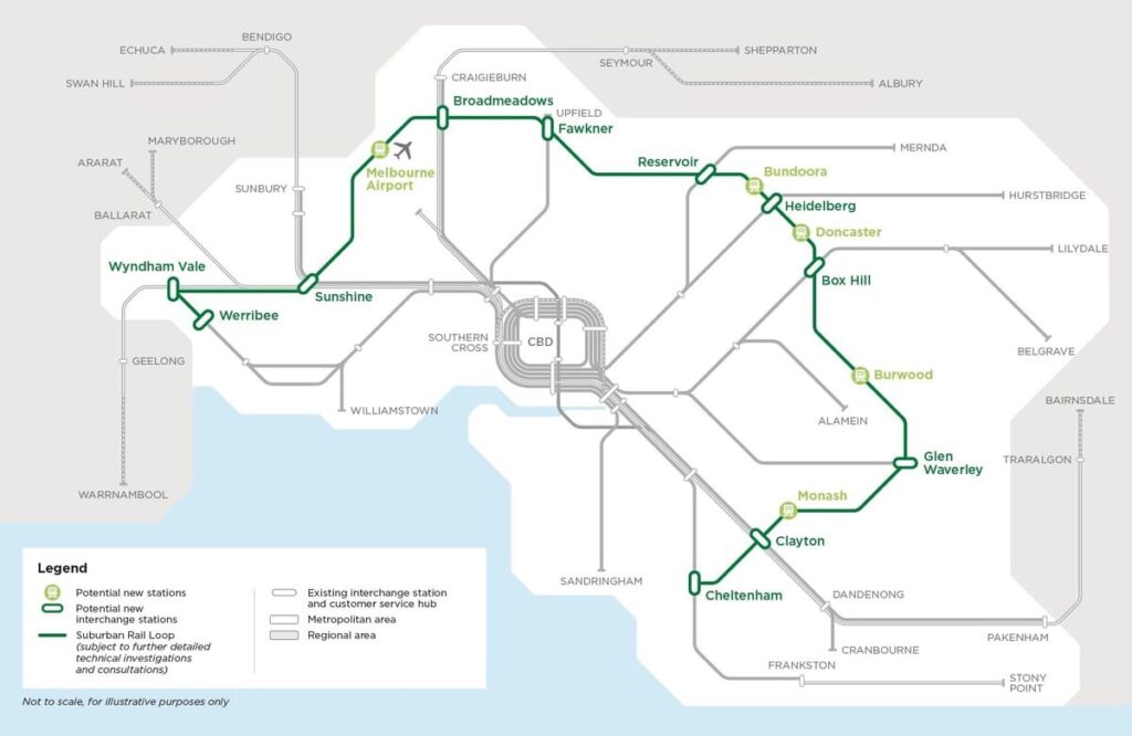
The Suburban Rail Loop (SRL) project aims to improve Victoria’s public transport system by creating an underground rail link, which will traverse suburbs 15–25 kilometres from the Central Business District (CBD) along an approximately 90 km route. It will span from the Frankston line to the Werribee line, including Melbourne Airport, and provide convenient travel between suburbs. This will alleviate congestion on existing railways and reduce reliance on roads.
Pre-construction Monitoring
“The Suburban Rail Loop Authority (SRLA) has contracted Sixense to provide a remote InSAR monitoring system. The purpose is to gather essential background data on movement and settlement, enabling the assessment of potential long-term ground movement trends within the project corridor during the pre-construction period.
The area of interest (AOI) for this project is located in the eastern part of Melbourne city, in southern Victoria. The InSAR study covers an expansive area of up to 150 km², encompassing the Stage 1 alignment of the SRLA project, which extends approximately 27 km in length.”
What we’ve delivered
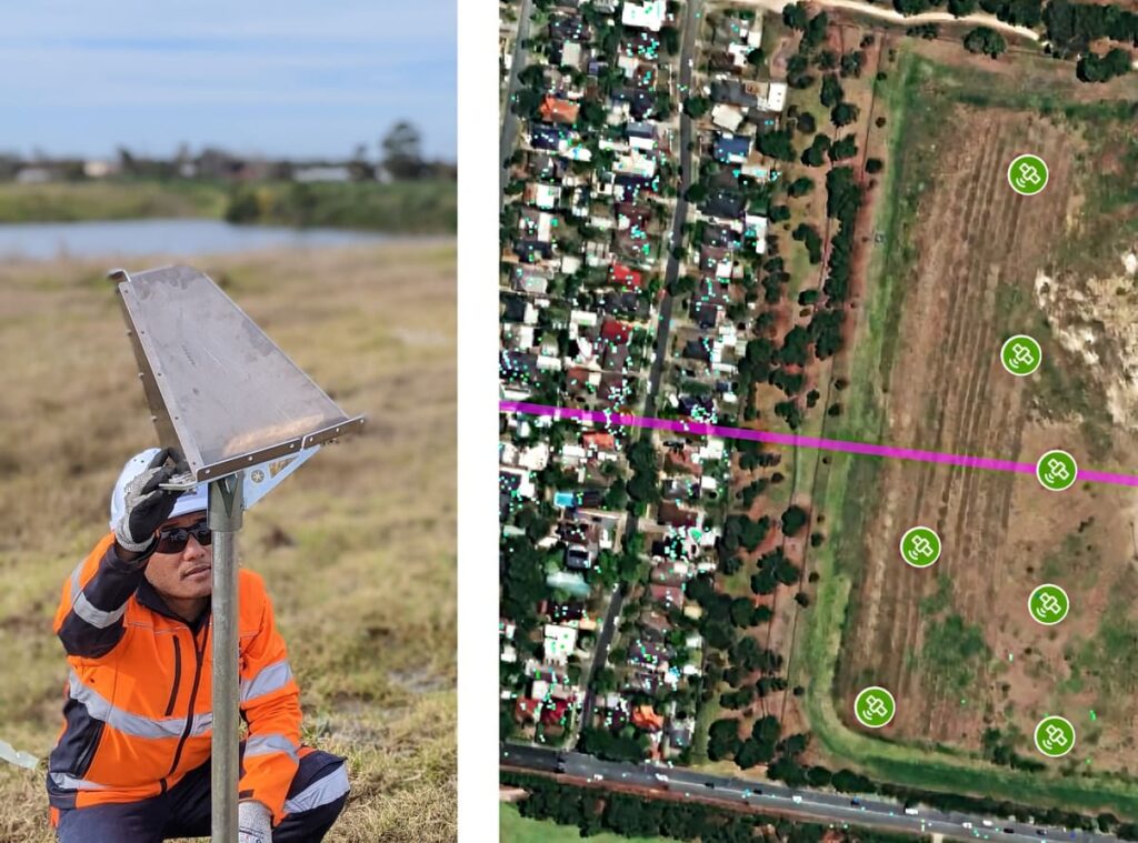
Sixense is conducting extensive baseline monitoring using Atlas-InSAR high-resolution technology. This monitoring is covering the tunnel alignment and its surroundings for a duration of four years prior to construction.
To complete the monitoring scheme, a set of Artificial Corner Reflectors (ACR) has also been installed to provide measurement data, either on green field where traditional InSAR processing is more limited, or on critical areas/points.
The results are delivered through the advanced web platform called Beyond Monitoring, optimised for displaying and analysing InSAR measurement results. This value-added service provides a comprehensive toolset for visualizing and analysing InSAR data.
Images of the project
km², Zone analysed
InSAR measurement points
Artificial Corner Reflector
Similar projects